Advanced Drone Services Beyond Agriculture
Elite Tech Drones leverages advanced drone and sensor technology to provide recovery, mapping, surveying, and training services across central Ohio.
Drone Recovery Services
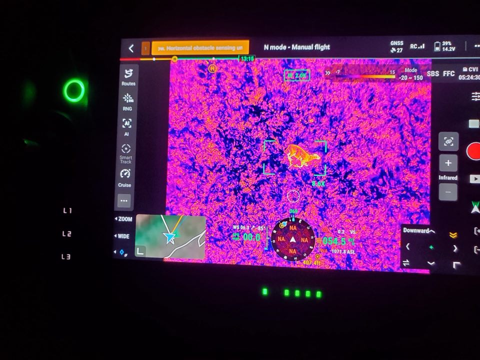
With today’s drone technology, locating lost animals no longer has to be a guessing game. Using advanced sensors, we can quickly locate:
-
Bedded deer
-
Lost pets
-
Livestock that wandered or escaped
Our drones identify heat signatures and hard-to-see locations that are nearly impossible to find on foot. When you call, we respond quickly to help recover what matters.
Surveying, Mapping & Aerial Imaging
Our drones deliver next-level efficiency for:
-
Farm and land mapping
-
Laser-ranging measurements
-
Centimeter-level precision surveys
-
Aerial photos and video
-
Property, project, or event imaging
We provide accurate data and dramatic bird’s-eye visuals to support planning, documentation, and decision-making.

Training & Support Services
We help you get started…and succeed in drone operations.
-
Drone selection guidance
-
Licensing and certification assistance
-
Setup and onboarding
-
Best practices and safety training
-
Ongoing technical support
We help you avoid costly mistakes and shorten the learning curve.
Need recovery, mapping, or expert drone support? Contact Elite Tech Drones Today!
